Flow modelling tools abound, for estimating flows in rivers and streams to determine the impact of rainfall events on flooding and conversely for monitoring the impact of droughts.
However, truthing a model can be difficult as most catchments often lack any form of flow or level gauging against which the models’ outputs can be verified. This problem can be overcome in certain locations such as chalk streams, drains and becks, through the deployment of portable level gauges, with fast sampling rates in order to capture transient responses to rainfall or the intricacies of diurnal flow patterns.
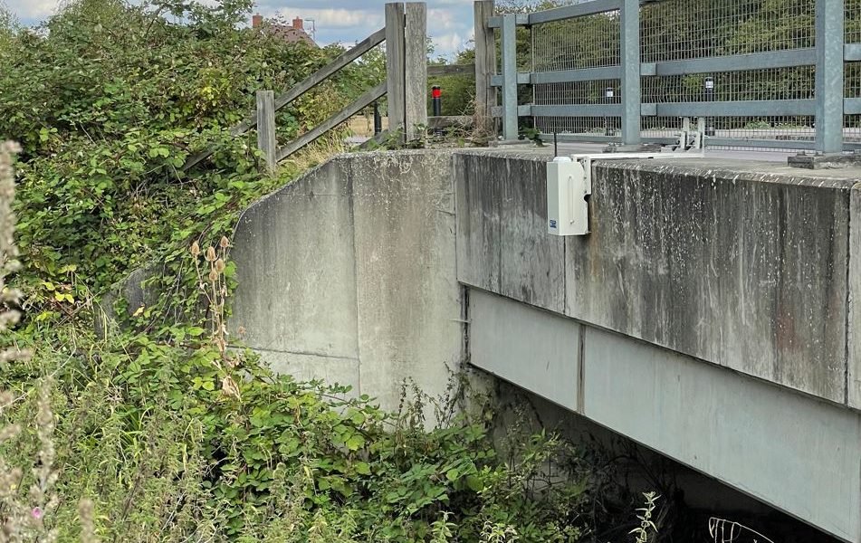
Best accuracy will occur when the fall of the water channel is gradual and fairly uniform between the gauging stations. Further, try to locate the gauging stations where there is a defined structure against which the area of the flow can be measured, such as a bridge.
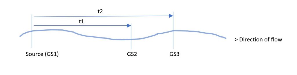
After applying some top end filtering and data analysis such as autocorrelation if the patterns are repetitive, it is possible to measure the time taken for the surges, peaks, and troughs to move downstream from their source to the points of measurement.
Simply, the faster the sampling, the more gauging stations deployed and the more accurate the derived average velocity of the flow will be. The best accuracy will occur in dry weather when the flow from other sources are least influential on the flows downstream.

Where:
GS1 is at the source such as the outflow from a Water Recycling Centre
GS2 is a location 1.5 km downstream, where the crest of the wave arrives 52 minutes later
GS3 is a location 2.06km downstream, where the crest of the wave arrives 70-minutes later
Velocity at GS2 = distance (G2-G1)/time = 0.48m/s
Velocity at GS3 = distance (G3-G1)/time = 0.49m/s
Average velocity = 0.485m/s
Radio Data Networks use their technology to support both drought and flood intervention schemes As such they have recently launched a comprehensive range of gauging stations for temporary deployment that can deliver virtual real-time data enabling this type of study to be undertaken at minimal cost.
Where permitted they have can also fabricate a range of customised temporary weir structures than can be used to calibrate flows at a chosen location more precisely too.